

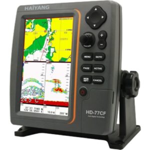
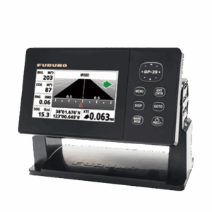
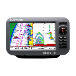
Haiyang HD 77cf


Haiyang HD-77CF Marine GPS and Fish Finder Combo – Your All-in-One Solution for Navigation and Fish Finding
The Haiyang HD-77CF is a high-performance marine GPS and fish finder combo designed to deliver unmatched precision in both navigation and fish detection. Ideal for fishing enthusiasts and professional mariners, this advanced chartplotter and sonar system ensures you stay on course while easily locating your next big catch.
- Description
- Reviews (0)
Description
Marine GPS Chartplotter with Fishfinder – Full Technical Specifications
Display & Power Specifications
Screen Size: High-resolution 7-inch wide color LED display with backlight for enhanced visibility in all lighting conditions.
Power Input: Operates on DC 12V to 36V with ±10% tolerance, ensuring compatibility with various marine power systems.
Operating Temperature Ranges:
Display Unit: -15°C to +50°C
GPS Antenna Unit: -25°C to +70°C
Compliance: Fully compliant with IMO Resolution MSC.112(73) for maritime navigation equipment.
Backup & Storage: Optional SD card support for data storage and software updates.
Chart Compatibility: Compatible with HAIYANG electronic charts via SD card slot.
Advanced GPS Receiver Features
Signal Type: Receives L1 frequency signals at 1575.42 MHz using C/A code.
Satellite Tracking: Supports 50+ channels for fast and accurate satellite acquisition.
Location Accuracy:
Positioning: ±2.5 meters CEP
Tracking Accuracy: ±2.0 meters CEP (based on HGP-430 specifications)
High Sensitivity Reception:
Acquisition Sensitivity: -140 dBm
Tracking Sensitivity: -149 dBm
Update Frequency: Position data refreshes every 1 second for real-time navigation.
Correction Support: Compatible with DGPS and SBAS systems including WAAS for improved accuracy.
Professional Chartplotter Functions
Map Projection: Utilizes Mercator projection for accurate nautical chart display.
Navigation Modes:
True Motion
North Up
Course Up
Head Up
Latitude Range: Covers global navigation from 85° North to 85° South.
Scalable Map Zoom: Ranges from 0.05 nautical miles to 1,500 nautical miles.
Geodetic Reference: Based on WGS-84 map datum.
Waypoint Storage:
20,000 user-defined waypoints
50,000 track points
100 customizable routes
1,000 draw points
1,000 area name entries
Chart Data Options: Supports Built-in maps, C-MAP, and HAIYANG (HY) chart formats via SD card.
Data Interface:
Output: NMEA-0183 standard
Input: NMEA-0183 standard
Navigation Alerts:
Arrival Alarm
Anchor Alarm
Off-Course Alarm
Interval Timer
AIS Alerts: Closest Point of Approach (CPA) and Time to CPA (TCPA)
Integrated Fishfinder Specifications
Display Capabilities:
Normal View (single or dual frequency)
Bottom Lock
Bottom Zoom
Real-time A-scope view
Transducer Frequencies: Operates at 50 kHz and 200 kHz (single or dual frequency modes).
Output Power Options:
Standard: 600W
High Power Option: 1.2kW
Depth Range & Speed: Measures depths from 2.5 meters up to 1,200 meters.
Image Speed Control: Offers 8 fixed display speeds including:
4/1, 2/1, 1, 1/2, 1/4, 1/8, 1/16, 1/32, plus stop mode.
Signal Rejection Features:
Interference Rejection: 3 selectable levels
Noise Filter: 4 levels for clean signal display
User Controls:
Gain Control: Automatic or manual
Range Selection: Automatic or manual
Depth Shift: Adjustable in both auto and manual modes
Pulse Length Configuration
White Line / Black Line Modes
Additional Sensors: Built-in water temperature detection
Optimize your marine navigation and fishing experience with this all-in-one GPS chartplotter and fishfinder system. Featuring cutting-edge satellite tracking, real-time charting, and high-performance sonar capabilities, it’s the ideal solution for professional and recreational marine operations.
Reviews
There are no reviews yet.