

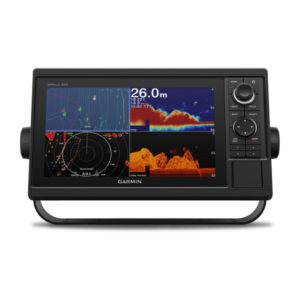
GPSMAP® 74xx/7600 Series


WORLDWISE BASEMAP
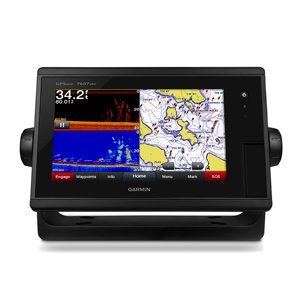
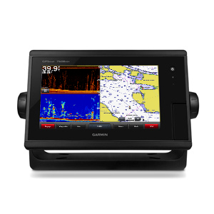
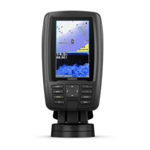
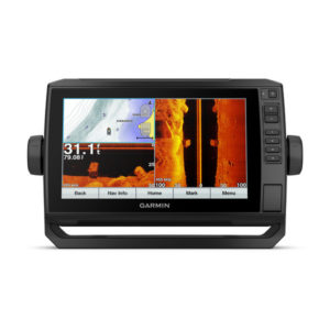
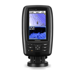
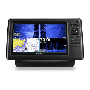
Sonar-SideVü, ClearVü and Traditional CHIRP
GPSMAP® 7407xsv
-
PART NUMBER: 010-01379-12 - 7"
GPSMAP®7408xsv
-
PART NUMBER: 010-01305-12 - 8"
GPSMAP®7410xsv
-
PART NUMBER: 010-01306-12 - 10"
GPSMAP®7412xsv
-
PART NUMBER: 010-01307-12 - 12"
GPSMAP®7416xsv
-
PART NUMBER: 010-01402-12 - 16"
Sonar – None
GPSMAP® 7407
-
PART NUMBER: 010-01379-10 - 7"
GPSMAP® 7408
-
PART NUMBER: 010-01305-10 - 8"
GPSMAP® 7410
-
PART NUMBER: 010-01306-10 - 10"
GPSMAP® 7412
-
PART NUMBER: 010-01307-10 - 12"
GPSMAP® 7416
-
PART NUMBER: 010-01402-10 - 16"
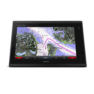
BlueChart® g3 and LakeVü g3
Sonar – SideVü, ClearVü and Traditional CHIRP
GPSMAP® 7607xsv
-
PART NUMBER: 010-01379-13 - 7"
GPSMAP®7608xsv
-
PART NUMBER: 010-01305-13 - 8"
GPSMAP®7610xsv
-
PART NUMBER: 010-01306-13 - 10"
GPSMAP®7612xsv
-
PART NUMBER: 010-01307-13 - 12"
GPSMAP®7616xsv
-
PART NUMBER: 010-01402-13 - 16"
Sonar – None
GPSMAP® 7607
-
PART NUMBER: 010-01379-11 - 7"
GPSMAP® 7608
-
PART NUMBER: 010-01305-11 - 8"
GPSMAP® 7610
-
PART NUMBER: 010-01306-11 - 10"
GPSMAP® 7612
-
PART NUMBER: 010-01307-11 - 12"
GPSMAP® 7616
-
PART NUMBER: 010-01402-11 - 16"
- Description
- Specification
- In Box
- Reviews (0)
Description
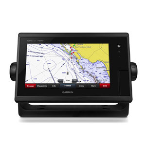
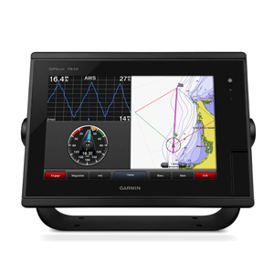
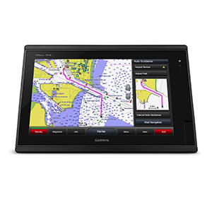
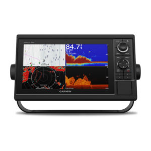
Choose from 7”, 8”, 10” 12” or 16” chartplotter/sonar combo models with touchscreen controls, support for traditional and scanning sonar, built in coastal charts and inland maps, networking capabilities and WiFi connectivity
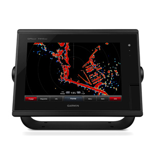
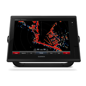
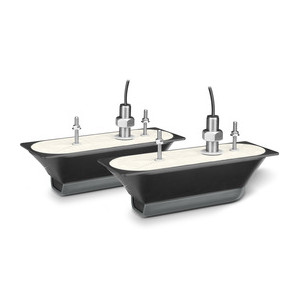
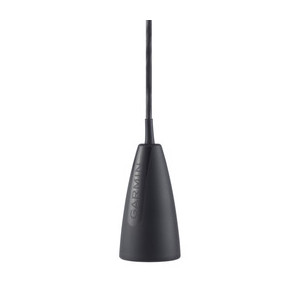
- Built-in dual CHIRP sonar plus CHIRP ClearVü and CHIRP SideVü scanning sonar with the clearest images on the water (transducer sold separately)
- High-sensitivity internal 10 Hz GPS/GLONASS
- Fully network capable for Garmin Marine Network and NMEA 2000®, plus NMEA 0183 support
- Supports GSD™ 26 professional sonar module
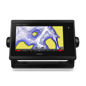
Preloaded BlueChart g2 maps
In addition to basic charts, tidal stations, currents, depth contours, IALA symbols and included fishing charts, BlueChart g2 offers smooth transitioning between zoom levels and more seamless continuity across chart boundaries. You can customize your screens with Safety Shading that allows you to shade all depth contours shallower than your boat’s safe depth. Fishing charts emphasize bathymetric contours with less visual clutter on the display. And there’s also a choice of standard 2-D direct overhead or 3-D “over-the-bow” map views for easier chart reading and orientation.
Garmin Marine Network and NMEA 2000 Support
Full-network compatibility allows you to add more capabilities to your boat. GPSMAP 7607xsv supports radar, autopilot, instruments, multiple screens, FUSION-Link, sensors, remote sonar modules, digital switching, thermal cameras, GRID rotary knob, joystick and keypad control, GXM™ 52 marine weather receiver and more.
| Garmin Radar compatible | ✓ |
|---|---|
| Garmin Sonar compatible | Yes |
| Garmin SmartMode compatible (customizable monitor presets) | ✓ |
| Supports AIS (tracks target ships position) | ✓ |
| Supports DSC (displays position data from DSC-capable VHF radio) | ✓ |
| Garmin Meteor™ Audio System compatible | ✓ |
| Supports FUSION-Link™ compatible radios | ✓ |
| GSD™ Black Box sonar support | ✓ |
| GCV™ Black Box sonar support | ✓ |
| ActiveCaptain compatible | ✓ |
| Garmin Helm compatible | ✓ |
| GRID™ (Garmin Remote Input Device) compatible | ✓ |
| Wireless remote compatible | ✓ |
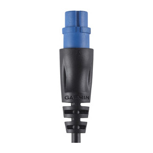
- Power/data cable
- NMEA 2000® drop cable
- T-connector
- Flush mount kit
- Protective cover
- Documentation

Reviews
There are no reviews yet.